Potential use of Lidar (light detection and range) to planning agrosilvopastoral systems in degraded lands in Amazon observing the Brazilian forest low and minimizing carbon emissions.
Potential use of Lidar (light detection and range) to planning agrosilvopastoral systems in degraded lands in Amazon observing the Brazilian forest low and minimizing carbon emissions.
Autoria: OLIVEIRA, M. V. N. d'.; FIGUEIREDO, E. O.; OLIVEIRA, T. K. de; PAPA, D. de A.
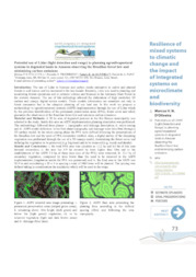
Resumo: The use of Lidar to biomass and carbon stocks estimative in native and planted forests is well known and has increased in the last decade. Recently, Lidar was used to planning and monitoring forests operations and to estimate volume and biomass in the Antimary State Forest in the western Amazon. The use of this technology allowed the elaboration of high resolution 3D surface and canopy digital terrain models. These models information are essentials not only to forest companies but to the adequate planning of any land use. In this work we propose a methodology to agrosilvopastoral systems (ASPS) implementation through the use of Lidar which by the previous identification of the permanent preservation areas (PPA), forest cover and relief, guarantee the observance of the Brazilian forest low and minimize carbon emissions.
Ano de publicação: 2015
Tipo de publicação: Resumo em anais e proceedings
Unidade: Embrapa Acre
Conteúdo relacionado
Observações
1 - Por padrão são exibidas publicações dos últimos 20 anos. Para encontrar publicações mais antigas, configure o filtro ano de publicação, colocando o ano a partir do qual você deseja encontrar publicações. O filtro está na coluna da esquerda na busca acima.
2 - Para ler algumas publicações da Embrapa (apenas as que estão em formato ePub), é necessário ter, no celular ou computador, um desses softwares gratuitos. Sistemas Android: Google Play Livros; IOS: iBooks; Windows e Linux: software Calibre.
Acesse outras publicações
Acesse a Base de Dados da Pesquisa Agropecuária (BDPA) para consultar o acervo completo das bibliotecas da Embrapa.