Busca de Publicações
Filtrar por:
| Autoria: ZHU, C.; LU, D.; VICTORIA, D. de C.; DUTRA, L. V. Mapping cropland distribution over large areas has attracted great attention in recent years, however, traditional pixel-based classification approaches produce high uncertainty in cropland area stati... ... |
| Autoria: CHEN, Q.; LU, D.; KELLER, M.; SANTOS, M. N. DOS; BOLFE, E. L.; FENG, Y.; WANG, C. Agroforestry has large potential for carbon (C) sequestration while providing many economical, social, and ecological benefits via its diversified products. Airborne lidar is considered as the most ac... ... |
| Autoria: LU, D.; BATISTELLA, M.; LI, G.; MORAN, E.; HETRICK, S.; FREITAS, C. DA C.; SANT'ANNA, S. J. Land use/cover classification is one of the most important applications in remote sensing. However, mapping accurate land use/cover spatial distribution is a challenge, particularly in moist tropical... ... |
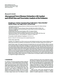
| Autoria: LU, D.; CHEN, Q.; WANG, G.; MORAN, E.; BATISTELLA, M.; ZHANG, M.; LAURIN, G. V.; SAAH, D. Landsat Thematic mapper (TM) image has long been the dominate data source, and recently LiDAR has offered an important new structural data stream for forest biomass estimations. On the other hand, for... ... |
| Autoria: LU, D.; LI, G.; BATISTELLA, M.; FREITAS, C. C. This research explored the integrated use of Landsat Thematic Mapper (TM) and radar (i.e., ALOS PALSAR L-band and RADARSAT-2 C-band) data for mapping impervious surface distribution to examine the rol... ... |
| Autoria: LU, D.; BATISTELLA, M.; MORAN, E.; HETRICK, S.; ALVES, D.; BRONDIZIO, E.
|
| |
Observações
1 - Por padrão são exibidas publicações dos últimos 20 anos. Para encontrar publicações mais antigas, configure o filtro ano de publicação, colocando o ano a partir do qual você deseja encontrar publicações. O filtro está na coluna da esquerda na busca acima.
2 - Para ler algumas publicações da Embrapa (apenas as que estão em formato ePub), é necessário ter, no celular ou computador, um desses softwares gratuitos. Sistemas Android: Google Play Livros; IOS: iBooks; Windows e Linux: software Calibre.
Acesse outras publicações
Acesse a Base de Dados da Pesquisa Agropecuária (BDPA) para consultar o acervo completo das bibliotecas da Embrapa.

